


Five stand out: the paved 2.2-mile Table Rock Lakeshore Trail, the 5.3 miles at Lakeside Forest Wilderness Area in town, the 5.6 miles at the Henning Conservation Area, the 11.75-mile White River Valley Trail System below the dam, and Dogwood Canyon's 10,000 paid acres. Fall color usually peaks around mid-October, and every one of these reads differently in it.
Which Trail Near Branson Fits Which Hiker?
Match the trail to the legs in your group: paved and level at the lakeshore, stone steps and caves in town, glade country at Henning, four connected loops below the dam for the all-day crowd, and a pay-to-enter canyon that welcomes walkers, riders and tram passengers alike.
Branson's trail card runs deeper than a show town has any right to, with more than 24 trail miles across the five systems below, and fall is when it earns the detour. VacationStar keeps hikers close to all five of these, and our earlier spring hikes guide covers the property-side trails this one leaves out.
Trail | Length and surface | Best for |
Table Rock Lakeshore Trail | 2.2 miles, paved and level | Strollers, wheels and easy mornings by the water |
Lakeside Forest Wilderness Area | 5.3 miles of trails, 315 stone steps | Caves, a grotto and bluff views inside town |
Henning Conservation Area | 5.6 miles; 3.4-mile Homesteaders Trail | Glades, an overlook and real quiet on Branson's west side |
White River Valley Trail System | 11.75 miles in four loops, natural surface | The all-day hikers and trail runners |
Dogwood Canyon Nature Park | 10,000 acres, paid admission | A full day with waterfalls, tram option included |
What Are the Easy Wins for a Fall Walk?
The Table Rock Lakeshore Trail and Lakeside Forest. The lakeshore path runs 2.2 paved, level miles between the Dewey Short Visitor Center and the State Park Marina, and Lakeside Forest hides 5.3 miles of trails, a waterfall, caves and a grotto inside the city itself.
The lakeshore trail is the one to hand to a mixed group: paved edge to edge, level enough for wheels, and the lake does the scenery on one side while the woods turn on the other. Lakeside Forest, at 412 Owen Lane, is the surprise: 140 acres of bluff country with 315 man-made stone steps dropping toward Lake Taneycomo, an old soldier's cave, and almost 2,000 feet of hand-built stone walls, open daylight hours. Our guide to fun things to do outside Branson pairs either with a fuller day, and an Ozark Mountain cabin puts the trailheads a short drive from your coffee pot.
Where Are the Real Hikes Near Branson?
The Henning Conservation Area on the west side of town and the White River Valley Trail System below Table Rock Dam. Henning gives you 5.6 miles through steep glade country with an overlook and lookout tower; the trail system stacks 11.75 miles across four connected loops.
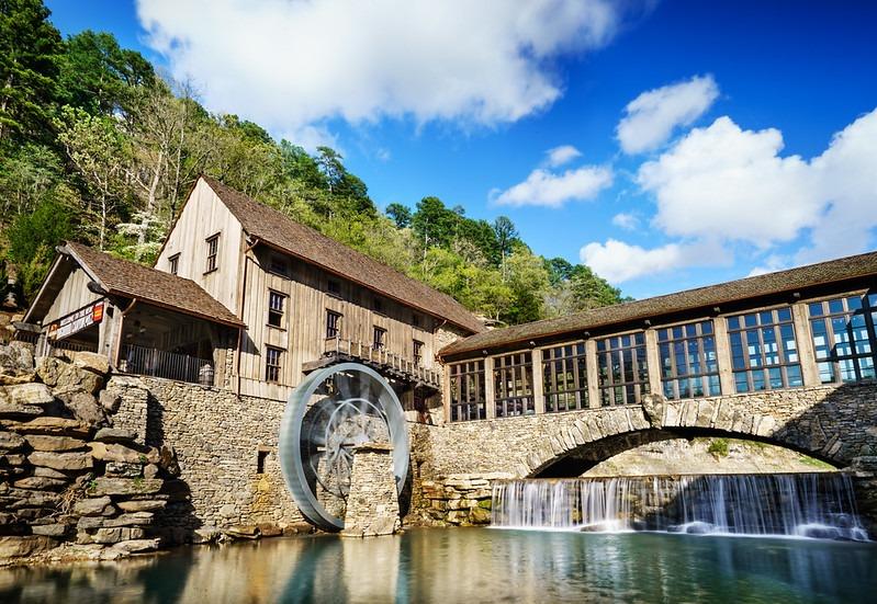
Henning is the closest thing to backcountry inside the town limits, with the 3.4-mile Homesteaders Trail and its 14 informational stops as the anchor route through oak and hickory that carries October's color. One planning note from the area's own page: the overlook gate closes at 5:30 pm from October 15, so late light gets tight in peak season.
The White River Valley system starts a mile south of the dam on Highway 165 and splits into four loops, with the 3.4-mile Blue Loop the longest single circuit and the 2.9-mile Red Loop the classic first lap. Pack a lunch either way, and our scenic picnic spots guide knows where the table with the view is.
Yes, with the honest caveat that it is a paid nature park rather than a public trail: 10,000 acres in Lampe with walking and biking routes past waterfalls and bluffs, a tram option for the non-hikers, and current admission posted on the operator's site.

Dogwood Canyon is the splurge day of a Branson hiking trip, and it solves the group problem the public trails cannot: the hiker, the biker and the person who wants a padded seat all cover the same canyon. Streams and waterfalls hold the scenery even outside peak color, which makes it the safest booking on this list for an early or late fall week.
When Should You Hike for Fall Color, and Where Should You Stay?
Aim around mid-October, most years, per Missouri's conservation department, and follow its weekly fall color report at mdc.mo.gov/fallcolor as the trip gets close. Base yourself somewhere with a washer and dryer, because five trails' worth of Ozark mud comes home with you.
The trails on this list do not move, but the color week does. Our guide to Branson in fall sets the wider season, and the booking logic is simple: mid-October weekends carry the demand, weekdays walk quieter. Fully equipped kitchens are standard across VacationStar properties for the early trail breakfast, hot tubs come with many of them for the after-hike soak, and when the trail week is picked, contact VacationStar with your dates and the group's trail list, and the team will find the property that fits both.
Frequently Asked Questions
Which Branson trail is paved and stroller-friendly?
The Table Rock Lakeshore Trail: 2.2 miles of level asphalt between the Dewey Short Visitor Center and the State Park Marina, per the state's trail sheet, with lake views the whole way.
What is the hardest hike near Branson?
By distance, the White River Valley Trail System: 11.75 miles across four natural-surface loops starting a mile south of Table Rock Dam on Highway 165. Henning's steep glade country earns respect too, mile for mile.
Do the Branson trails cost anything?
Dogwood Canyon is a paid nature park with current admission on its own site. The state park, conservation area and city trails on this list post no admission charge on their pages; check each operator's page for current rules before you go.
When do the trails show peak fall color?
Usually around mid-October, and it shifts year to year. The Missouri Department of Conservation tracks the turn with a weekly fall color report from mid-September to mid-November, updated most Thursday evenings.
Are there caves on any of these trails?
Yes. Lakeside Forest Wilderness Area's trails pass a waterfall, caves and a grotto, including an old soldier's cave along the path of its 315 stone steps, all inside the city at 412 Owen Lane.
Where should a hiking trip stay in Branson?
Central beats remote, since the five trailheads ring the town in different directions. Branson condos keep the morning drives short in every direction, with full kitchens and Wi-Fi, and pool access for the recovery afternoon.
What else is worth finding off the main drag?
Plenty, and hikers tend to be the travelers who find it. Our hidden gems and offbeat spots guide collects the stops that pair naturally with a trail day.
How do we set up a fall hiking trip?
Pick the color window, then the trails, then the base. Call (877) 495-4991 with your dates and the team will sort a property near the trails your group has circled.